GRAPH BOOKS: PRINTED MATTER FROM RADICAL ART AND SOCIAL MOVEMENTS.
FEMINIST HISTORIANS OF MATERIAL CULTURE.
Allegorical Map of Mexico City and Environs
Carlos Herrmann, ca. 1930-1935
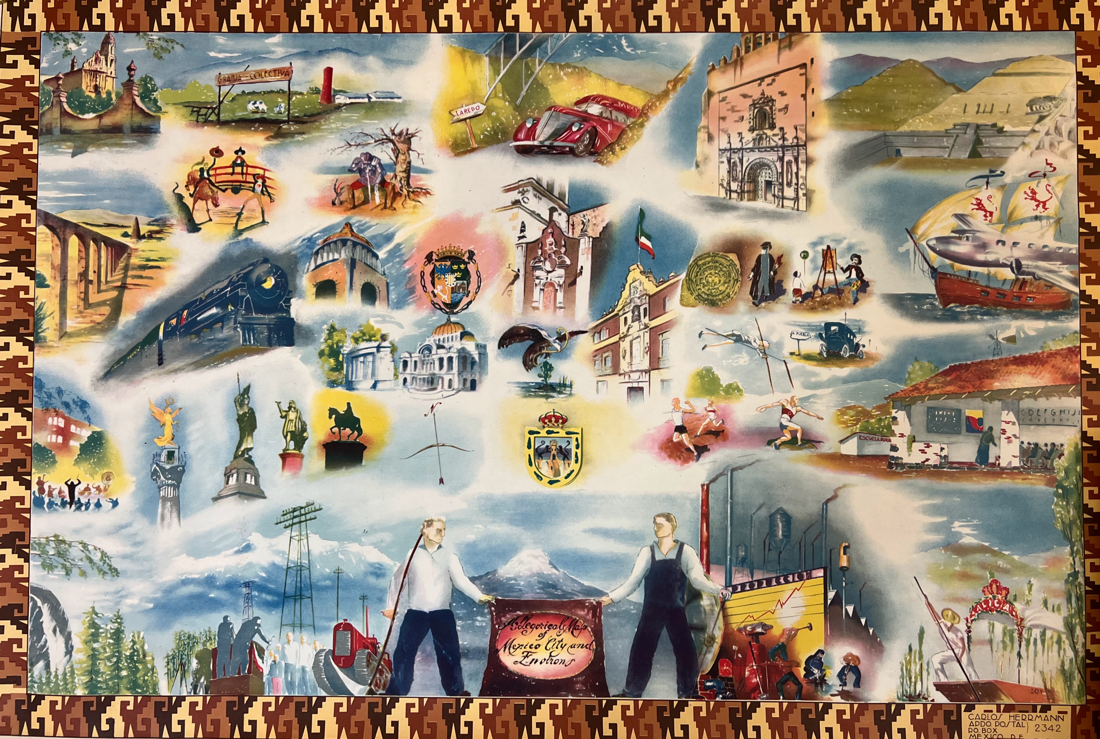
(Pictorial Cartography) Herrmann, Carlos. Allegorical Map of Mexico City and Environs. Mexico, D.F.: n.d, ca. 1930-1935. 63.5 x 92.3 cm. Image very good, blind margins a bit worn, beginning to fray.
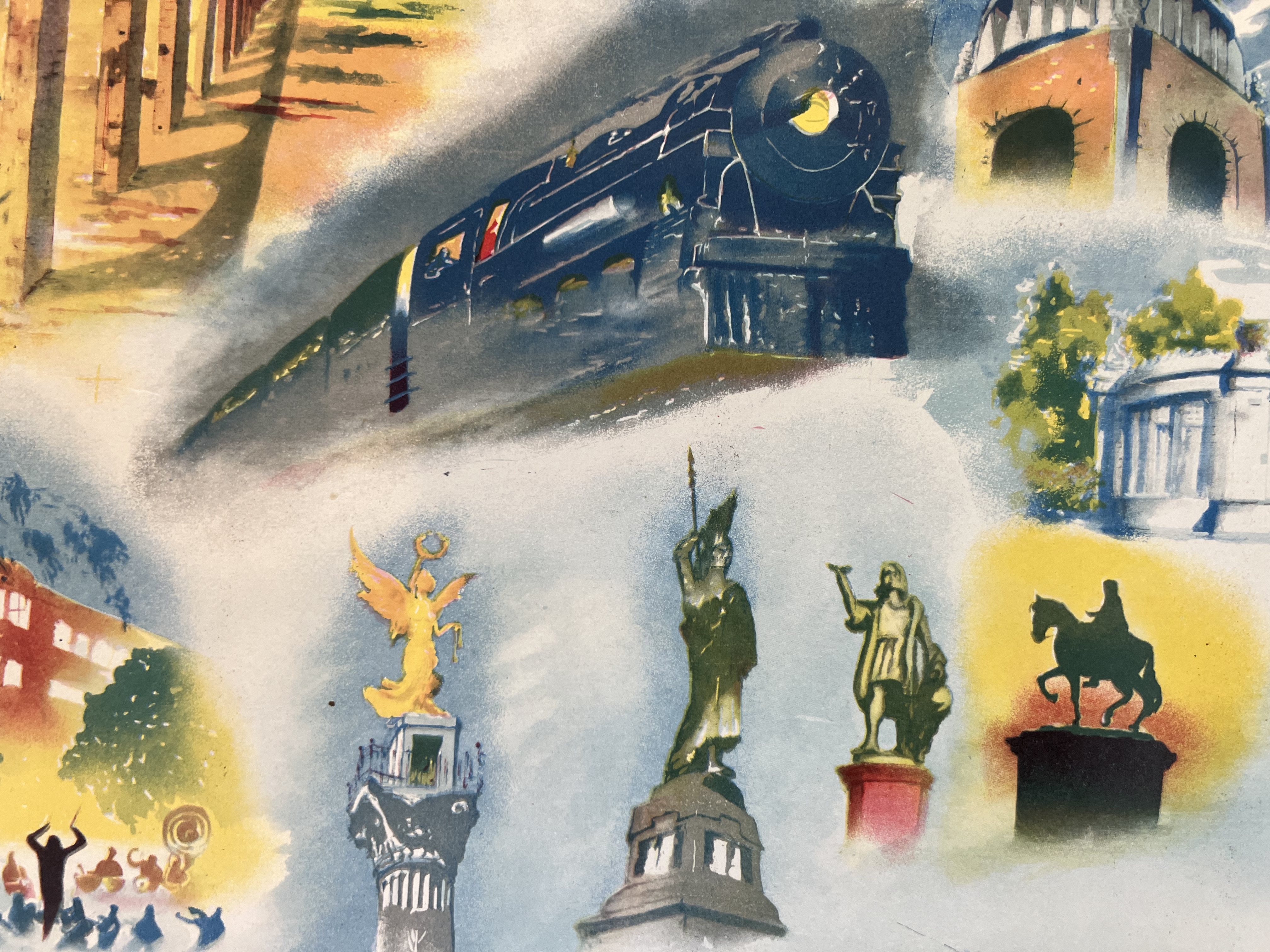
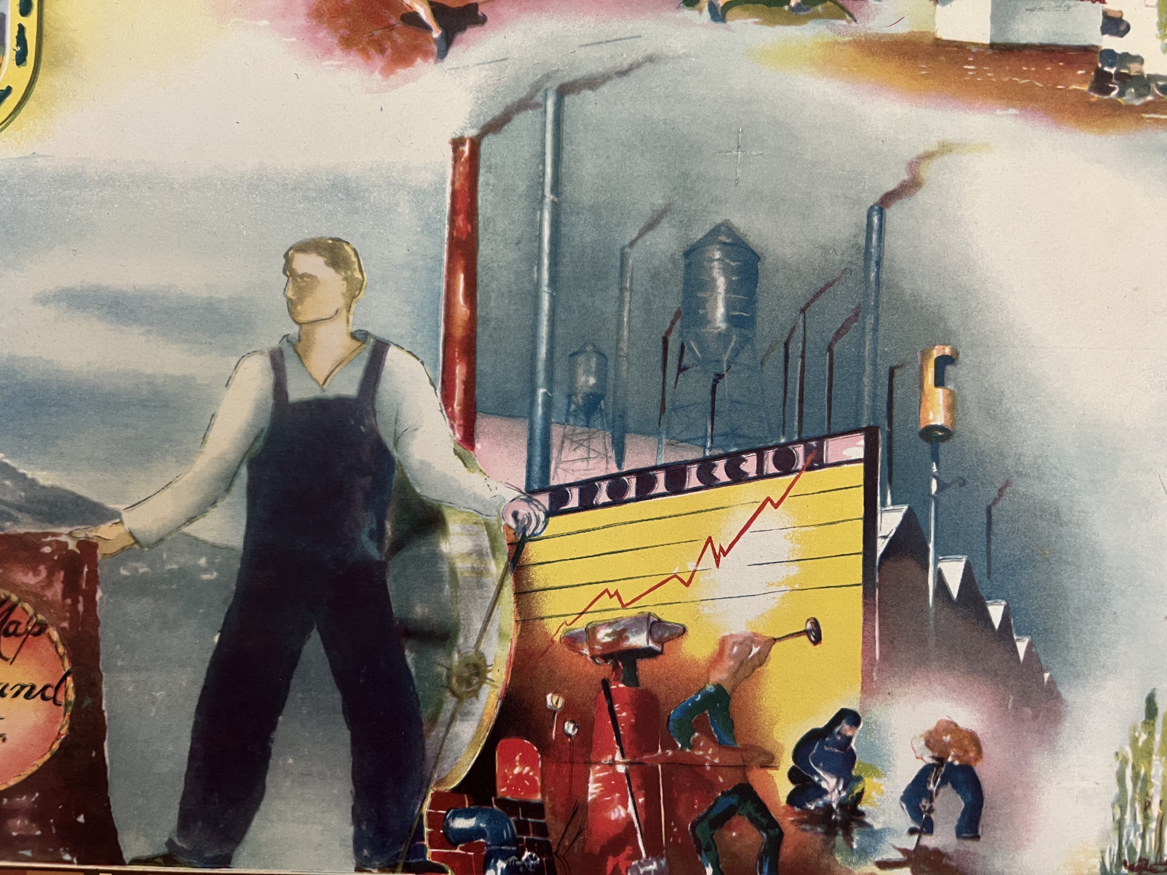
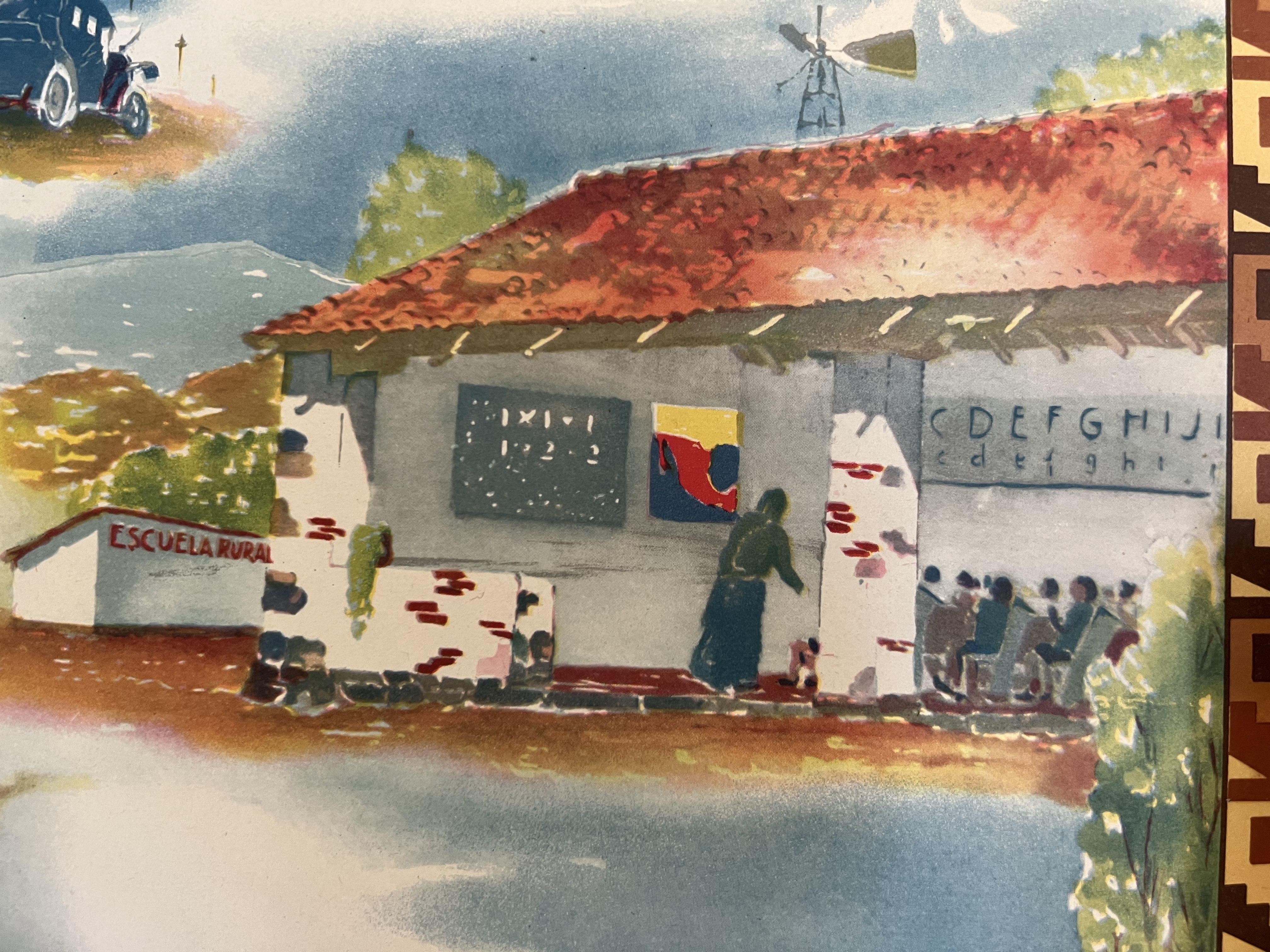
A pictorial map of Mexico City, representing the natural, industrial, architectural, and cultural landmarks of the city. The artist blends indigenous styles and historical references with colonial and postcolonial features, identifying the key features of Mexico’s emerging modern national identity.
Probably printed in the 1930s during the Maximato, when as Delia Cosentino has argued, “the production, circulation, and consumption of such imagery offered the opportunity to imagine a uniquely animated geography coming into its own … [C]artography, [was] an advantageous way to shape the view of Mexico as a cohesive entity with a rapidly developing infrastructure and an evolving relationship with its own Indigenous past and present. [...]. Through these images dating to the first half of the 1930s, an international cadre of artists, travelers, publishers, government officials, and other boosters disseminated an integrated vision of Mexican cultural space and thereby coproduced the territory itself.” (1)
Known from a single other example, in the David Rumsey Map Collection.
$950
Notes:
1. Delia Cosentino. “Unfolding Maps during the Maximato in Mexico,” Latin American and Latinx Visual Culture 1.1 (January 2019).